Friday, May 30, 2008

Anchored on Nupani Reef


S10deg 02.938 E 165 deg 42.603

Left Lata this morning, accompanied with a bunch
of dolphins, decided not to beat back to the Reef
islands and went to check out Tinakula instead, a
nice broad reach, and pushed 20 miles further to
check out if there is bird hunting going on on
Nupani Island for filming purposes.


so we went looking for birds but the trees were too tall to film

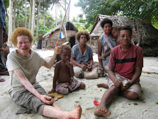
Thereafter, we went to the village and the local cooked a fish on their fire for us. They had never seen a digital camera and loved seeing themselves!


The anchorage consists in hooking the edge of the
reef, as there is a steep drop off. The KUNA is hanging
two boat length from the reef edge, and thanks to the Easterly
wind, is kept away from it, hoping no westerly squall
will come tonight. Conditions seem stable for the
night and tomorrow will investigate entrance to the
deep lagoon.

Wednesday, May 28, 2008

Leaving Taumako for Ndendo island

Finally got out of Taumako Island,
with relief. Despite 25 knots at sea when
we left, and 2.5 m swells, it was more comfortable
than the rolly anchorage. Picked the best time to
weigh anchor too: there was no current. Villagers
greeted us with pawpaws and some pig meat
(rought in a leaky coconut basket it put a lot of
fat on the decks, to my despair, after havign one
week of local helpers eating betelnut, coconut and
smoking cigarettes, the KUNA needed a good
seawash in rough seas!!!

100 miles from Taumako to Lata in a SW
course took 20 hours as we were trying to
slow down and the wind died at the end of the
night replaced by a light land breeze. Lata has a
nice protected bay but an extremely deep harbour
with onlyone sheltered anchorage possible in Luesalo
(Shaw POint on the Eastern side of the bay, which
used to have a logging wharf). Even there, KUNA sits
in 15-20 m on old coral.

Hem now, glad to rest from 6 days of a rolly anchorage waiting for BBC Huw
Cordey producer to fly in.

May 28th still hanging there but not for long!


the joy of rolling at anchor

Spent another night managing local crew so they get
even amount of rest, I don'tseem to get anywhere
with that and every time I get up myself to do the round I
find the watchman asleep. If not, I had one singing
to stay awake while the other snoring, so either way,
I don't get much sleep out here!!!!

The weather
hasn't gone down and the anchorage is getting wilder
and rollier so hoping to put to sea today, even in
20knots+, the run down wind to Lata on Nendo
Island will be more comfortable! Just checked the
anchor: amazingly it has not moved despite the
35 knots gusts of last night, it's picked in a solid
bit of coral and rounding one bommie. BUt the
chain has now trashed a fair surface of coral. In
this exposed corner, the coral is fairly trashed by heavy waves
anyhow, but it's sad anyhow.

The boat will be packed full, I am swaping my
solomon crew Philip (not good enough for the job
unfortunately) so taking him back to fly back to
Honiara and replacing him with the son of one
of the Taumako navigators for help on the
voyage to Anuta. Of course negociating fair rates
is never an easy one, as one must make sure everything
is clear and agreed upon in advance. On top of it, may
take Mimi's colleague back too, provided they'd like
to contribute payment for their ride back to Lata.

A canoe ride over the 90 miles between Taumako and Lata
is 1000US otherwise but the weather is too heavy for canoe.

Over and out for now, I better get another coffee into me!
fred:)

Monday, May 26, 2008

May 26th - wearing out!

I have plenty of time to write and just about enough power for the computer
using the wind but getting really worn out by hanging on in another squally
night on the same deep spot. The deep coral bommies tangled the chain with the
current constantly turning, shortening the catenary. Sharp jerks animate KUNA
in a rumble of chain and there is no point letting more out, as it would mean
more to get tangled in the coral. I can't really snorkel on the chain, 18m is
just enough to eyeball it and run out of air and I am reluctant to use scuba as
I want to save the tanks for Anuta and Tikopia in case worse problems happen.

Tomorrow, I am hoping to go and see the sail on the Vaka canoes, too much rain
today and no wind, and also hoing we get out of there soon! The island must be
lovely if on the hard land!

Pics to come!!
F:)

Sunday, May 25, 2008

May 25th - On taking local crew...


The wind patterns have been tightly associated to the
semi diurnal tides cycles here: "when tide go up,
wind hem com" say the locals. This has been true of
the last four days: easterlies increased to 15 knots
as the tide went up but last night violent squalls
hit, with dark clouds and thunder. So here I am, still
in the same spot, wildy rolling around with the tidal
currents opposing the winds, recovering from a night
up checking anchor at all times, despite having two
watchers onboard to do the night job for me, as at
most times I found none of them awake!!

Getting local crew can be good but needs some management.
It turned out that Philip, our Solomon island crew
picked up in Honiara knew a few of the locals, a fine
diplomatic choice to have brought him to Taumako island
if not a practical one: His seamanship skills had
dropped to very little in the last 20 years since he
worked on the Rainbow Warrior and local ships. Had
to teach him sailing again.
So I was happy to find some other minders for the boat
to help in case I had to escape in the middle of
the night, though being islanders, pidgin is now
the language of choice on board, I am learning fast
but it still causes communication problems when I
want to get something done fast or when a family of
five jumps onboard before I have even got time
to say anything!

One of my helpers, Patrick, has sailed to New Zealand
with Mimi and I am going to take him to Anuta
Island as he seems to know and have the initiative
to sail a yacht out in case the anchor drags.
Such crew swap is a bit of a drastic measure
but no time to muck around.

In the meantime, the KUNA has been the home of
two locals at all time and I feel the difficult
lack of personal space for either parties of
different cultures, let alone having to apply the
local custom dress code on my own boat, like
being embarrassed of wearing short togs to go
and check the anchor !!!

Monday May26th

F:)

Saturday, May 24, 2008

May 24th - Taumako Canoes


Te Puke canoe under sail, photo by Wade Fairley

The Vaka Taumako canoe project aims to preserve the
building knowledge of large size sailing canoes,
which use to passage across the pacific and transcribe
and understand the traditional navigation techniques
of Taumako inhabitants.


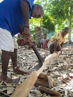
Cutting the timber for transverse beams

If you'd like some information
on this , please check www.aloha.net/

This has been
the 14 years dedictated work of Mimi George and team, American
based in Hawaii who spent every tradewind season on
the island and even sailed there twice with her yacht
29' Gryphon. The canoes have these amazing crab shape
sails which apparently are the best aerodynamic design
to go upwind. I yet have to sail on them to confirm this as I remain unconvinced this beats kevlar!

A remote island spoiled by money...

And Solomons cash, there is no more onboard the KUNA!
As it turned out, the cost associated with the BBC
filming went down to even using our personal cash. A canoe sailing session for
filming did cost 1000US dollars (prepaid!), and a sequence
on sewing the sails would only happen in exchange
of a pig being purchased, let alone every canoe
ride, for which two 44 gallons were ordered (much
more than needed for a few canoe rides up and
down a 2km for 5 days!)
Unfortunately, the fuel
planned for the job did not arrive in time, so
KUNA is down to its last drop of outboard fuel
for having donated most of it too. Not good when
the only life raft onboard is the dinghy!!!


The "cash cow" culture seemingly hit in amongst
the islanders who have been accustomed to have a "project" bringing fuel and money. The traditional navigation/canoe project has certainly progressed but it has changed the mentalities by introducing money to the island, and the fuel they desperately need to run their motor canoes, their primary mode of transport between the small islands of the Duff group empowered the project leaders. It is a bit paradoxical, given that the project is ALL about sailing!!! It has also created some tensions on the island because only one or two villages directly benefit from the work activities/money and the villages on the other side feel left out and as a result, I may have missed out on a good anchorage (see further). Other educational and health community development projects are also ongoing and may definitely be of more benefit to the islanders: for example, an American eye surgeon visited Taumako for a few weeks this June to help people with their vision (cataract, etc..)


Anchorage on the extreme NW of the island, where swells of either side meet...

Despite having local crew minding the boat in 12 hours
shifts, I have been bound to stay on the KUNA, especially
as we have had to re-anchor on the NW side of the island
due to the wind shifting to the East. A little bit of
protection was found on the extreme North end of the
island(S 09 deg 51.65 E 167 deg 09.41). The locals say
there is even kind of a passage into a protected lagoon anchorage
but the village opposite does not allow anchoring
unless extortionate amounts of money are expanded. Saying this, for future yacht visits, one should enquire in advance and something can be worked out with the man of the land, for sure.


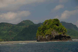
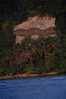
a nice bit of geology
So here I am bobbing around on the other side of
the island now.

Friday, May 23, 2008

May 23rd Taumako island first anchorage.

S 09 deg 52.953 E 167deg 11.688

Well, there is no such thing as an anchorage on Taumako
( I am saying that as I am listening to the chain
dragging on the coral on the eastern side of the
island.


The island NW-SE direction provides no shelter in trades wind. KUNA was first anchored on the eastern side as the wind was still to the SW upon arrival.


Yesterday, in order to be able to unload
all camera gear, we dropped the pick in about 10m
depth, a flat coral step with only short and flat
acropora I had all intentions of getting out of
here straight after but Mimi, the American woman
in charge of the canoe project convinced me to stay
for the welcome ceremony.


Something you can't really
refuse as it is custom for Taumako people to welcome
new visitors with a dancing and singing and speech
from the elders.


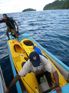
Launching the kayak in the canoe, for me to be able to return quickly to the boat at low tide if the weather turned

Despite having one of the locals
dive on the anchor to make a terribly ugly chain
and anchor knot around the biggest bommie he could
find (which was too small!) , and having tied a
buoy to the anchor itself to be able to retrieve
it at night, there was no way I slept knowing that
the wind was about to turn East, putting us on
a leeshore with the reef edge 80m away!!!. The
friction of 40 m of chain on the short coral held
quite well, though I feel really sorry for the
destruction involved. Actually, what holds a boat
in this location is the very strong tidal currents,
which half the time goes in a southerly direction,
pushing the boat against the wind. You get the picture
of a very rolly anchorage but it turns out to be
quite safe as most of the time, the KUNA was hanging
forward of its anchor!!!!

Thursday, May 22, 2008

May 22nd - Taumako Island!


The problem when planning a landfall in the morning
is try to avoid arriving there to early. After
an HF sched with Taumako island yesterday, planned
to get there 7:30am or so and spent the whole night
trying to slow us down!!! Very frustrating when for
once, winds were perfect and we could have sailed
7-8 knots on a NE course from Reef islands to Duffs.
Around the Duffs, there is an outer barrier reef
(visible on the Google earth picture). It is a deep
reef (10-20m, not accurately charted) but waves can
breaks in places is the reef is hit by deep ocean
swells. So no joke there. The reef materialized with
a high concentration of white caps, due to current
but nothing too big to be scary.


As we got closer to Taumako, 2 mile inside the reef,
the lush green vegetation of this high volcanic islands
shaun in the sunrise and some houses appeared behind
pristine sand beaches. The island raises quite high,
300m or so, above sea surface, half volcanic, half coral
plate and it felt like arriving to Macquarie Island
for it looked extremely wild, especially in a strong
southerly wind.

Wednesday, May 21, 2008

Passage from Honiara to the Duff -End


Wednesday May 21st
Pidgin island, Reef Islands

Pidgin is one of the Reef Islands, a group of coconut
covered sand cays on elevated coral plates. Pidgin Island
is in fact leased by an Australian, Ben Hepworth,
whose parents were given the island in exchange of
them staying around with the resupply boat for the
local villages. Ben's parents colonised this tiny
coral cay by building several houses and lived
amongst the locals, running a old North Sea trawler
as a resupply ship. They later lost the boat for
being late in changing its mooring spot when North
Westerly unexpectedly winds came in the cyclone season
(so I was told the story). They are buried on the island
and Ben who grew up there with his twin brother,
stayed up there, marrying a local woman and evolved
into a true islander though maintaining comms and
emailcontact with the real world!. Both Ben and brother
Ross' local knowledge has been great logistic help
for the BBC shoots as they know the local and are
pretty much the only one who can provide canoe transport,
fuel if needed.

The anchorage behind Pidgin Island is in 20-25 meters
coral and sand. Amuzingly, Ben told me to drop the
pick on a 8 by 10 m wide coral bommie at 8 m depth,
for which he gave me the GPS position
(S 10deg17.868' E166deg17.810'). The chart
(UK 17) which it was out by 1km in the past,
appeared to be accurate! Reluctantly tried
the bommie, as apparently all ships do it,
but the anchor dragged (as predicted) so the
deep sand and coral were the go. In anything
west of south, the anchorage is very rolly
and wind leeshore but this spot would be perfect
in the SE-E trades. Hoping to visit it again!

Tuesday, May 20, 2008

Passage to Duffs continued


Tuesday May 20th
12 noon, S 09deg 56.88 E 165deg 04. 41
After a very squally night during which winds pushed
the KUNA to the north of the route, wind stopped forcing
us to motor again. Nothing particularly interesting
happened, except we caught a dolphin fish with a squid
lure, making for a good dinner! Given the very small
route distance difference, I decided to go via the Reef
Islands, to reccie the anchorage there, behind pidgin
Island, in case I could not anchor in Taumako. The new
route involved going further south, threading between
Nupani reef which hosts a large seabird colony and
Tinakula, a young volcanic island, culminating 800
meters above seawater. The top of Tinakula is bare.
Apparently, at night, one can see it erupting on the
western side at the moment, but no luck. In amongst
the low clouds, we just caught a brief glimpse of it
as most of the night was rainy and clouded over.

Monday, May 19, 2008

Passage from Honiara to the Duff Islands

Had a few days in the Russels but I'll come back to
that as I have been busy resupplying the boat and
not able to connect to the internet in town! Now I
am relating the passage over 500nm to one of the
most remote islands in the Solomons, the Duff group out East.

Pics to come next time I can connect! :)

May 15th. Honiara.
The anchorage in front of the yacht club in Point
Cruz is not much of an anchorage in fact with room
for three yachts, two of them being on moorings and
the rest of available depths 20m or more, close to a
reef shoal, or too close to the police boats jetty,
which need turnaround space, the whole lot open to
the afternoon northerly squalls! KUNA had no choice
but to pick up a mooring (upon advice of the two other
yachties) hoping the owner would not get too upset if
we stayed a couple of days and that it was a decent
mooring (to deep to check on snorkel though!)

Once upon a time, this town my have been a nice spot but
it is now looking rather mad. It is basically one long
road between the shore and the hills going from the
airport strip to the less populated marshy land to the
west, with a thick flow of cars driving the third world
style! Across the water form the anchorage, the yacht
club is a bit of a haven with 24 hours security guards
and great fish and rice meals for cheap, a good contrast
to the sterile luxury of the Mendana hotel next door
along the beach (though nice to pull up there by kayak
for a nice meal too!). It is easy to pull up there with
the dingy and get some fuel from the petrol station 100m
away and cross the road to try and find decent supplies
in the chinese supermarket. Imported food cost a mint here,
so does "bush kaikai" (ie custom fruit and vegies, all
the traits of booming city. Apparently, rents in Honiara
is as costly relatively as in WashingtonDC!


Saturday May 17th

4PM S 09¼ 22.8 E 16011.4
Left Honiara in next to no wind, strangely enough as all
the previous days, the build-up of heat above this high
land (2500m is the highest mountain) normally attracted
a nice 15 knots N-NE breeze in the afternoon, but today
no luck and just blazing heat in which we had to motor.
The sea was mirror calm, which was perfect for spotting
whales. At least 12 Minkies were spotted in Iron Bottom
sound and Lengo channel further to the East. The north
coast of Guadalcanal has a number of capes to round
before heading to the SE but none of the charted lights
were sighted. The tide streams did the unexpected so
ended up pushing two knots of current, The tidal regime
changes from diurnal in Honiara to semi diurnal in the
Lark channel 20 miles away, and but possibly the tidal
predictions out though I am not too sure!

Sunday May 18th

12 Noon, S 09¼ 47.9 E 161¼36.6
After heading South East all night (motoring and light
NW breeze with spinnaker on at the end of the night),
in the morning, rounded the south east end of Malaita
island which has a reef and a couple of rocks sticking
out. Pass this point, it was possible for the Kuna to
take the route straight east to the Duffs, some 325 mile
away, following just north of the 10th parallel (easy
one to plot!). Ulawa island some 20 miles further east is
the last before a long stretch of open sea where swells
from NW and S-SE are now felt. It was a change, after
the well protected waters of the "slot" (New Georgia
sound) and Indispensable Straight. Too well protected
in fact, which made for the absence of wind in the last
month! It is now pretty enjoyable to be able to SAIL
- for real!- in light NW winds, with open ocean
influences rather than desperately trying to catch
katabatic winds off steep volcanic islands (though
tropical katabatics are much nicer than the Antarctic
ones!).

Monday May 19th

12 Noon, S 09¼ 55.6 E 163¼26.3
Now the wind has turned westerly as it looks like we
are following a low pressure system, though very light.
We the headsail poled out, it is possible to do 4.5
knots straight East but it is a struggle with the rig
bashing whenever the Kuna is loosing speed. Lucky we
unloaded most of the camera gear in Honiara (and sadly
the dive compressor and surfboard) as the loss of
weight made for performance for sure!! A slow zig zag
course was followed most of the day, except for one
squall, which gave us all a good shower and 10 L of
drinking water, and increased the watch average from
10 miles to 15!!. The wind slowly turned to the South
as predicted by the grib, finally making it possible
for sailing on course, at 5-6 knots and without
bashing the rig.
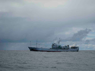


KUNA crossed a mine field of fishing lines at about
2 pm, something you would not want to run into at
night because the buoys have absolutyely no lights,
or signally device. There was 4 no boats patrolling
in the area, laying lines and retrieving them, so
their lights would be the only way to tell at night,
hoping they do't stay too far away from the lines!
The deep grounds 60 miles east of Ulawa Island are
up to 4000 m deep!

Wednesday, May 7, 2008

May 7th camp in the rainforest: a croc sighted!


Who would enjoy sleeping in a rainy dark rainforest full of ants and mozzies in the most basic set up ? One tarp for all camera gear and Hennessy Hammocks for beds: this special hammocks are an enclosed cocoon protected at the top by a mossie net over which a small tarp hangs to keep dry. They are DRY AS, well vented, keep you off the creepy crawlies from the wet ground. Good in case of flooding but with the only inconvenience that the bottom nylon fabric is unfortunately not mosquito-proof: the persevering island mossies bite your bum through, aye!


Doubling as “Making of” camera person, I had no choice but leaving the Kuna to accompany those guys by the lake: a croc was sighted on the opposite side at dusk and another one at dawn and saw tracks of a small croc on the muddy shore too! There is a fine line between filming crocs and staying safe away from them…


Mark tiptoeing on mangrove roots. The freshwater lake is in fact tidal, being so close to the sea, the salt water permeates through the limestone.

Tuesday, May 6, 2008

May 6th A Crocodile reccie


Between Liapare Island and Vella Lavella, lays an
incredibly beautiful channel bordered by mangrove
with clear turquoise blue water running over sand
and coral. We boated through at night and saw the
eyes of one small crocodile glow in the torch beams.
Confirmed unfilmable.

The following day, after a couple of hours walk to
the closest village on Vella, the BBC croc hunters
learned that quite a few of the crocs can be seen in
a freshwater lake behind the village. Of course the
custom fee to see the lake was rather prohibitive and
had to be re-negociated. Accompanied by a bunch of
locals, the team made it to the lake, an old volcanoe
caldera lifted out of the sea surrounded by thick
forested shores growing on the limestone of the
uplifted coral reef.


Nested in old coral plate, the lake is surrounded by high cliffs.


Lots of fossils shells (young
fossils) are scattered through the forest and also
a pile of human skulls, remnants of the time of the
head hunters. (Not longer than a century ago, Solomon
islanders used to cuts head of enemy tribes members,
but I don't know the details of that custom).
Access to the custom hulls was agreed upon after long
deliberations and an extra fee which suddenly made
local villager Joel remember where the skull site was!

Saturday, May 3, 2008

May 5th Crocs at the slipway!


Returning from Choiseul took even more time
as KUNA punched into southerly squalls where
neither sailing nor motoring were an option!
By 2pm, after dodging some narrow reef passages,
including a blasted 1.8 meter gap, KUNA pulled
into an allround protected anchorage of
Liapare island, a mecca for a few yachts as it
is a private slipway ran by an ozzie guy!!
Knowles Hudson has been there for 20 years
and is married to a solomons islander, nurse
Rosie. They operate a bit of a tourist guest
house somewhat hidden in the middle of a chaotic
collection of boats, boat parts, trucks, etc..
and employ a number of Solomon islanders tradesmen.

During the troubles in Honiara, Knowles repatriated
quite a few of his company trucks to the slipway,
to avoid them being pillaged. Sadly, the tsunami
did a lot of damage to the flat strip of island
where the slipway sits, wiping away hangars, workshops
and boats, ie turning it into a mess. Boats at
anchor in the bay, interestingly, rode the wave with
not damage. That was a fortuitous place to land in
as the windvane trim tab needed a stainless steel
welding job done. It got hit by a tree trunk or
something during the night.


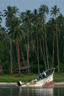
The slipway guys also seriously intend to refloat this japanese fishing boat and fix it!

The croc problem.

According to Knowles, a large crocodile comes to
the beach next to the slipway and even enjoys
sunning himself on the slipway concrete. He's
taken a couple of dogs and some pigs around the
place and Mark is really keen to film it. Knowles
is keen to kill it as it has become dangerous to
the locals and not good for tourism.


Before the guns were removed from the Solomons
islands by the peace keeping force, many had the
opportunity to shoot the unwanted animals, well
for the short period of instability when guns
were out. RAMSI is now in
charge of helping the locals by doing crocodile
kulls. People reckon that nowadays there are many
more crocs and they are causing problems throughout
the islands. Most people we talked to have croc
casualty stories to tell, far or close. The growing
crocodile danger is not so much the result of the
lack of guns to eliminate them but rather due to the
Solomon islands population is rapidly expanding
pushing people to live and use areas that are
crocodile habitat, therefore exposing themselves.
Its seems that the croc population is definitely
expanding too, like it is in Australia.


a venture on the reef flat.. tide is too low to cross with the dinghy!

So we came back and built a hide for the infrared camera out of coconut leaves on the beach with the help of the security guy Laudi and a few pikininis (kids in pidgin). A night of waiting for the crocodile is coming up!

May 3rd Across New Georgia Sound for Choiseul... and back!


there and back... meandering track is due to squalls


Left Kukundu in the morning, en route for Baga Island, the next bat colony location. Some communication break down prevented us to meet producer Mark Brownlow in time so in joined from Gizo underway, dropped off by motor canoe.

Mark settles in onboard a boat overflowing with pelican cases: straight into rushes!

Motoring under pouring rain for most of the day,
Mark decided that light was not going to be worthwhile the stopover in Baga so made it for Choiseul, the rat location for Voza, an overnight trip of 70 miles. Night crossing from Vella LaVella to Choiseul poses the only problem of fish aggregation devices, which are not lit at night, so had to look out for some dark raft thing with a bunch of flags, hard to detect in the peach dark New moon squally night so hoped not to run into one.

Shoals lay out 8-10 miles south of the coast of North choiseul so arrival in daylight necessary to shoot through the shoals. In the next morning, found just before the shoaling area a wide line of current which noticeably smoothed waters over.

Not long before, Mark had remembered to tell us that we were in fact going to Toro, at the extreme north of the island in Choiseul bay, some 15 miles further north. From there, one can see Bougainville and the Shortland Island to the North west. There was a constant 2 knot current flowing SE when we arrived in Choiseul Bay.

95 miles trip proved unsuccessful: the plane which was supposed to bring the scientist who was going to help search for the giant tree rat ran out of fuel and landed in Gizo! Next plane not before a few days!!! Weight anchor and reversed the route on the GPS. 18 hours of motoring for nothing and had to do it again straight away!

Choiseul Bay looked great, nice sandy anchorage off the wharf in 10 m of water and beautiful deserted islands, looked like possible surf break too...


The first few hours of our return trip were sailed in light winds


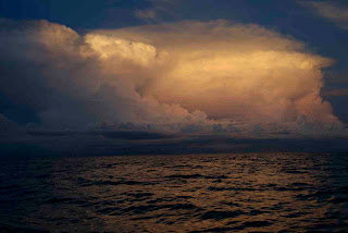
But the build up was a sign of the squalls to come in the night..

Thursday, May 1, 2008

The Kolombangara conservation project

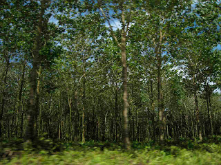
Plantation forest near Ringgi Cove
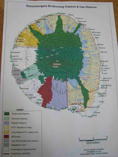
The area in green are the main reserve but a new area to the left between Kukundu and Rinngo cove is going to benefit from a new status
View of Kolombangara volcanic islabd from Kukundu

Chris Filardi has been initiating a collaborative conservation project aiming to extend and reinforce protection of the conservation areas of Kolombangara Island. The footage obtained for the BBC series we are currently working on would play a role in conveying the significance of this ecological zone which still contains many undiscovered species of frogs, birds, etc.. Due to insular evolution, a large proportion of the fauna and flora is endemic, thus precious as not found anywhere else! Both the local plantation forest company (KFPL) and the Kukundu college will be involved in the project, providing multidisciplinary initiatives and opening research centers accessible by tourists.