
Kolombangara island is located directly east of Ghizo. Villages are spread all around the coastal slopes with quite a few harbours which can be used for anchoring after carefully crossing reef entrances. The larger township of Ringgi offers a harbour with a deep entrance and and some deep anchorages.

Kolombangara is the large round volcanic island with Ringgi Cove located to the South East of it.

The summit gets rapidly covered in cloud through the day's heat build up and drowning rains generally follow. Looking forward to get to the top!! :)
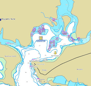
The harbour was well surveyed during WWII so the bathymetry on the chart can be trusted. Be careful of the fringing reef in the middle. The harbour is very protected and even a squall can barely build up much waves. There has basically been no wind in the last month, and only I hope that the trades would pick up eventually but at least, it meant leaving the KUNA in the harbour was pretty safe from weather if not from theft.
The brand new infrared battery door alarm that makes a lot of noise probably was a good enough a deterrent. If not, parking in front of Rocky’s security house and slipping a 50SBD note for him to look after the boat was!
Ringgi is a company town, dominated by the timber company KFPL buildings and houses. It has a couple of stores, a public phone and the store even sells mobile phone cards. Market on Tuesday, Thursday, Friday is sometimes well supplied, sometimes only offers betelnut. Supplying for a rainforest camping trip was a challenge, as only a couple of manioc roots could be found!!! For dry stores, best is to go to Noro, 5 miles away on New Georgia Island. Basically, do not count on the local stores except for some tuna and rice.

Kuna on a stopover at Noro Wharf
A year after having first landed on Kolombangara island during the BBC shoot (see blog archive may 2009), another visit was arranged to collect media for the newly formed Kolombangara Island Conservation Association.
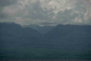
View of the crater and its opening to the South East.
In December 2008, with the support of the local timber plantation company (KFPL) and the Solomon Island Community Conservation Partnership (SICCP), the local community agreed on supporting conservation of the upper part of this large volcanic island, ie the zone above the 400m elevation contour, which includes the deep crater and ridges up to the summit, 1600m high. To encourage and stimulate donations for conservation, the KFPL supported the construction of a rainforest lodge with stunning views on the crater slopes and truly the best rainforest bird watching observatory conceived. Our role was to bring these stunning view to the outside world, by collecting some imagery that would help encourage donations for conservation.
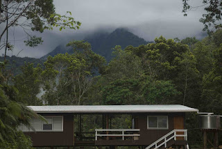


The lodge is located at the end of a logging road, at 380m height, 15km drive away from the coastal company town of Ringgi. Walking tracks will also progressively be cut into the rainforest for visitors to access the crater, the summit and the river banks. This tourism project aiming for high-end customers to visit this very special place will create jobs for the community for guides and lodge carers. For example, the track along the Vila river, which runs out of the crater, takes the adventurous trekker to heritage sites, where skulls from the times of head hunting are kept. Indeed, a large portion of the wet river banks inside the crater have been terraced by the people who escaped the head hunters by living in the thick and wet rainforest.


skull...

From a photographer’s point of view, the rainforest environment is spectacular but challenging. The climate up at the lodge is milder than the stuffy heat of sea level: temperatures only a few degrees lower (25 instead of 31!) seem cool due to the high humidity. The Sony EX1 camera held up to the task, even in dripping moisture, which often destroys video equipment. Portable and light weight, it was carried up and down steep gorges to capture the views of the crater and the deep and intense rainforest vegetation (an assistant was also carrying our Miller tripod daily). We rigged up a makeshift dolly and a jib made out of local timbers cut with a bushknife. The local production tools look a bit archaic, but there is no way to receive things into the country, so they did the job.

tropical timber jib

dolly filming tree roots

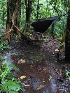
wet camp... glad about the rainforest hammock!
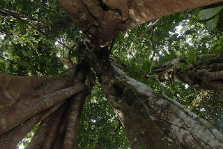
Walking between tall trees, it is very rare to get a really photogenic view from a vantage point, except where there has been a land slip or a tree falling. Wildlife is heard more often than seen, with hundreds of bird calls and dozens frog calls. The rainforest is also very wet, unpredictable heavy rain showers being nightmare for electronics and the terrain difficult: steep muddy slopes and slippery river bed rocks are common fare. Despite all of this, with a bit of patience, ingenuity and camera equipment holding up to the field conditions, lots of nice shots were collected.
